Linemap
The Linemap superimposes LINESTRING objects onto a geographic
map. Uses include tracking shipping and transportation routes in real time, and
studying geographic features such as fault lines.
| Features | Quantity | Notes |
|---|---|---|
| Required Dimensions | 0 | |
| Required Measures | 1 | Measure Geo (a LINESTRING column). |
Examples
This example uses a dataset that maps geological fault lines in the United States of America, similar to datasets available at the Koordinates.com site. Set the Geo field to mapd_geo.
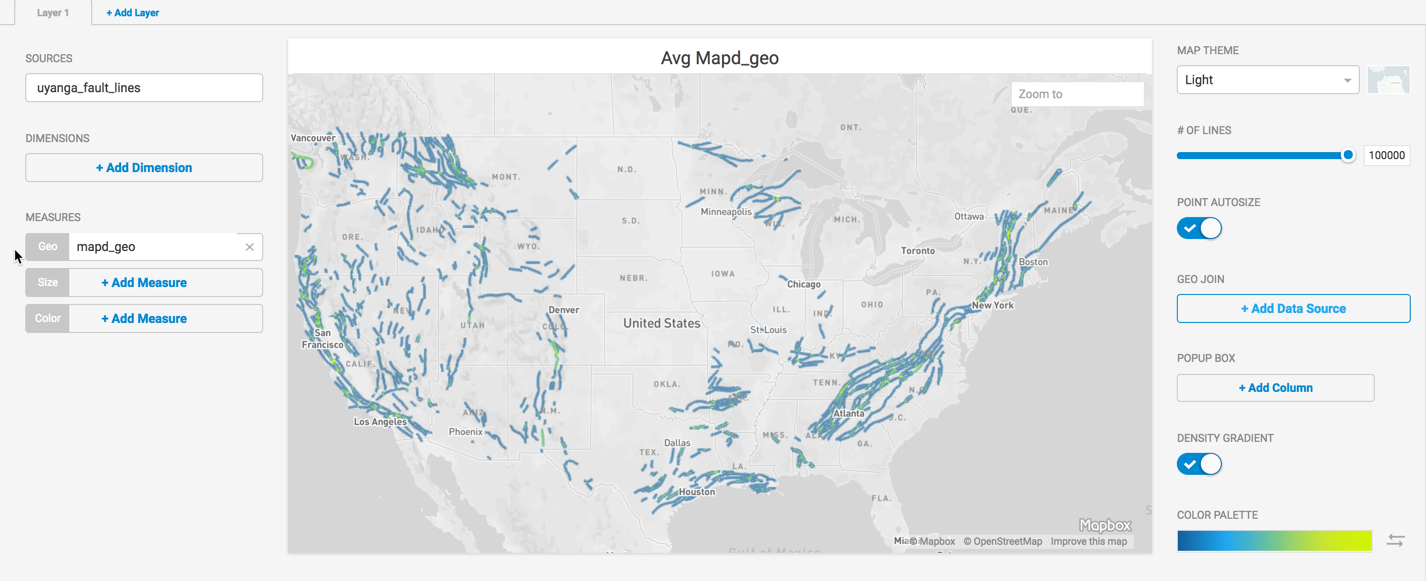
You can use length to determine the width of the lines to make longer faults stand out. You can also use a text label for the color, which provides a legend and a guide to the type of faults displayed.
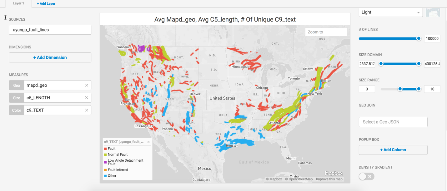
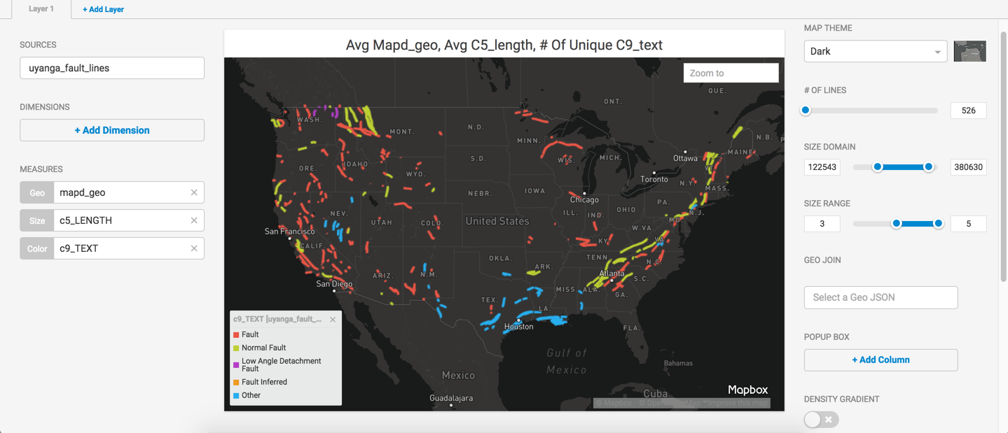
You can fine tune the graph further with enhancements such as changing the map theme, reducing the number of lines, changing the size domain and range, and adding values to the pop-up box.
Loading Linestring Data for Linemap
You can load your own linestring data to create Linemap charts. Linestring coordinates must be:
- expressed as longitude latitude
- between -180 to 180 (longitude), -90 to 90 (latitude)
North and East coordinates are positive numbers, South and West are negative numbers.
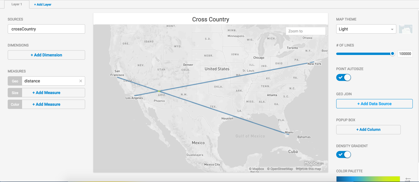
For example, you can import this CSV file with coordinates for Los Angeles to New York, San Francisco to Miami.
- Save the following content as crossCountry.csv.
cities,distance
"LA-NY","LINESTRING( -118.2437 34.0522, -74.0060 40.7128)"
"SF-MI","LINESTRING( -122.4194 37.7749, -80.1918 25.7617)"
- Open Immerse
- Choose the Data Manager tab.
- Click Import Data.
- Click Import data from a local file.
- Click the + icon to browse for and open your file.
- Click Preview.
- Name the table crossCountry.
- Verify the data is correct and click Import Table.
- Click the Dashboards tab.
- Click New Dashboard.
- Click Add Chart.
- Choose Linemap.
- Click + Add Data Source.
- Choose crossCountry as the data source.
- In the Geo field, click + Add Measure.
- Choose Distance.
- Your Linemap links Los Angeles to New York, San Francisco to Miami.