MapD

Main Content

Tutorials

  • Tutorials Overview
  • Installation Recipes
  • Loading Data
  • Using MapD Immerse

Analysts

  • Analysts Overview
  • Introduction to Immerse
  • Working with Dashboards
  • Measures and Dimensions
  • Using Filters
  • Creating Multi-layer Charts
  • Immerse SQL Editor

Immerse Chart Types

  • Chart Types Overview
  • Table Chart
  • Text Widget
  • Number Chart
  • Stacked Bar Chart
  • Horizontal Bar Chart
  • Pie Chart
  • Bubble Chart
  • Scatter Plot
  • Heatmap
  • Geo Heatmap
  • Histogram
  • Line Chart
  • Combo Chart
  • Pointmap
  • Choropleth

Appendices

  • Country Abbreviations
  • US State Abbreviations
  • US County Names

Administrators

  • Administrators Overview
  • Starting and Stopping MapD Core Services
  • MapD Core Services and Utilities
  • Getting Started on AWS AMI
  • Getting Started on GCP
  • Upgrading MapD
  • See also:
    • Installation Recipes

Data Import/Export

  • Importing Delimited Data
  • Importing Geospatial Data
  • See also:
    • Loading Data with SQL
    • Exporting Data with SQL

Configuration

  • Configuration Flags and Runtime Settings
  • Using servers.json to Configure Immerse Options
  • Hardware Configuration Guide
  • High Availability
  • Distributed Systems
  • Optimizing Performance
  • Adding Your Own Branding

Developers

  • Developers Overview

Sample Apps

  • Sample Applications Overview
  • Hello MapD
  • Hello MapD (Local)
  • Kafka Streaming

Vega User Guide

  • Vega Overview
  • Vega at a Glance
  • Vega Tutorials
  • Vega Tutorial Source Code
  • Try Vega
  • Vega Accumulator Example
  • Vega Source Data Type with Transforms
  • Vega Reference

Connectors

  • Connectors Overview
  • JDBC
  • ODBC
  • pymapd
  • Python JayDeBe API
  • RJDBC
  • Apache Thrift
  • See also:
    • mapd-conn

SQL

  • SQL Overview

Data Definition

  • Users and Databases
  • Roles and Privileges
  • Tables
  • Views
  • Datatypes and Fixed Encoding

Data Manipulation

  • Data Manipulation (DML)
  • Loading Data with SQL
  • Exporting Data with SQL

Geospatial Functions

  • Using Geospatial Objects
  • See also:
    • Importing Geospatial Data

SQL Editors

  • mapdql
  • SQuirreL SQL Interface
  • See also:
    • Immerse SQL Editor

Releases

  • Releases
  • New in 4.0
  • Known Issues
  • Frequently Asked Questions
  • Site Map

Forums

  • MapD Community

Try Vega

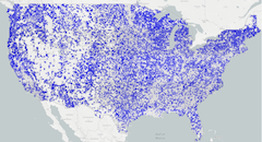
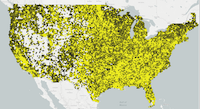
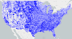
You can now try out the powerful MapD Vega engine. The database used for the examples includes over 100,000,000 rows. The data is based on the political donations dataset. Some columns have been stripped so that the data can fit on one NVIDIA Tesla P100 GPU.

Try It: MapD Vega Editor

The following examples are available:

Simple Pointmap

./images/6_simple-pointmap.vg.png

Pointmap With Scales

./images/6_pointmap-with-scales.vg.png

Grouped Pointmap

./images/6_grouped-pointmap.vg.png

Square Heatmap

./images/6_square-heat-map.vg.png

Hexagon Heatmap

./images/6_hexagon-heat-map.vg.png

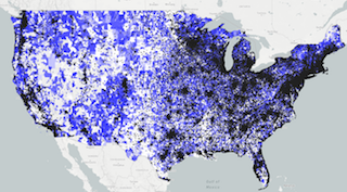
Choropleth Visualizing 43000 Zipcodes

./images/6_choropleth.vg.png

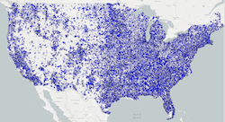
Multilayered Map (Point and Choropleth)

./images/6_multi-layered-map.vg.png

Version 4.0 ©2018 - MapD Technologies