
Using Filters
Immerse lets you narrow the data in your visualizations by clicking areas of the chart on which you want to filter.
For line and histogram charts, filter by dragging left or right along the chart to select a range (brushing).
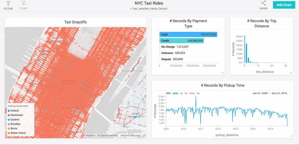
For point map and scatter plots, filter by zooming in on regions. Hold the shift key to select a rectangular area of the map and zoom in. You can also use the mouse wheel or trackpad to zoom in and out.
Point maps also provide a Zoom To field, where you can zoom to a particular geographic location by name. You can enter a country, a city, or something as specific as a street address.
For other charts, click the section of the chart on which you want to focus.
Inverse Filters
You can also choose to filter out certain data. Click the chart element you you want to suppress while holding down the Command key (Macintosh) or Control key (Windows/Linux). This feature is available for all chart types other than line, histogram, point map, and number.
Global Filters
Immerse lets you filter data at the dashboard level, constraining data for all charts on the dashboard. Global filters essentially act as a WHERE clause in SQL in a dashboard. You can use multiple global filters together and on fields of all types, including arrays.
To apply a filter, at the top of the dashboard
screen, click Filters, click Add Filter, then select the column on which
you want to filter. Available filtering depends on the data type of the column. For example, on string columns, you can search using options such as Contains or Equals.
You can use multiple global filters together, on fields of all types, including arrays. You can also use global filters for geospatial functions.
Examples: Using Multiple Global Filters
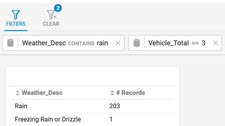
The following chart reflects two applied global filters: description of weather that includes rain, and vehicle total greater than or equal to 3. The Clear button shows how many filters are applied.
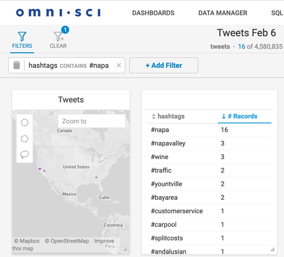
The following example shows multiple global filters used on an array field:
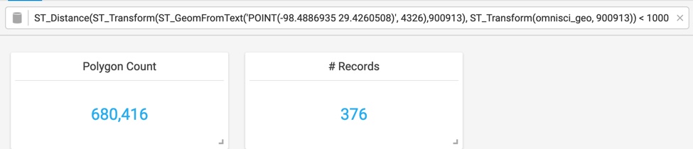
In the following example, the SQL code filters for polygons closer than 1,000 meters from the Alamo, which has a lon/lat of -98.4886935 29.4260508:
For more information about geospatial objects, see Geospatial Functions.